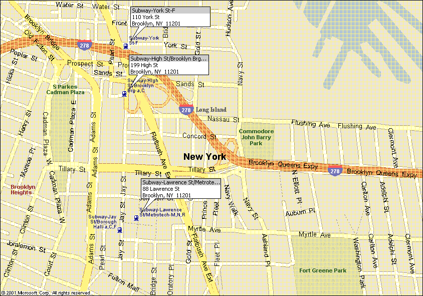
DIRECTIONS TO COMMODORE BARRY PARK, Navy and Nassau Streets, Brooklyn
Detailed Map of the Commodore
Barry Park Area
Map of the Driving Directions
from both Manhattan Bridge and Brooklyn Bridge
Field Location:
The Park is located across the street from P.S. 287 Bailey K. Ashford School
and can be seen from the BQE. Parking
is available on the street.
By SUBWAY:
Subway - Recommended Directions:
F train to York Street. Emerge from station and turn left. You
are now on Jay Street. Walk up Jay
Street, turn left on Sands, walk down the hill and turn right on Navy Street.
The park is a 1 block from there on the left. Use the BQE as a guide.
From the Manhattan Bridge
Stay in the right lane on the bridge and exit toward the
BQE. Stay right as you exit. Turn right on Sands and turn right on Navy. The
park is a block from there.
From the Brooklyn Bridge
Stay in the right lane on the bridge and exit toward the
BQE. Stay right as you exit. Turn right on Prospect Street. When you get under
the Manhattan Bridge, turn right on Jay. Turn left on Sands and turn right on
Navy. The park is a block from there.
From 3rd Ave., Brooklyn
Cross Atlantic, then cross Flatbush. The Brooklyn Academy of
Music is on your right. Take first left on Ashland Place. Follow Ashland, which
turns into Navy Street, under the BQE. When you emerge from under the BQE you
will see the field on the right. Field 2 is the closer to Navy Street.
On Foot
(I am told that it can be done) across the Brooklyn or
Manhattan Bridges from Manhattan, or up Tillary Street from Cadman Plaza in
Brooklyn.